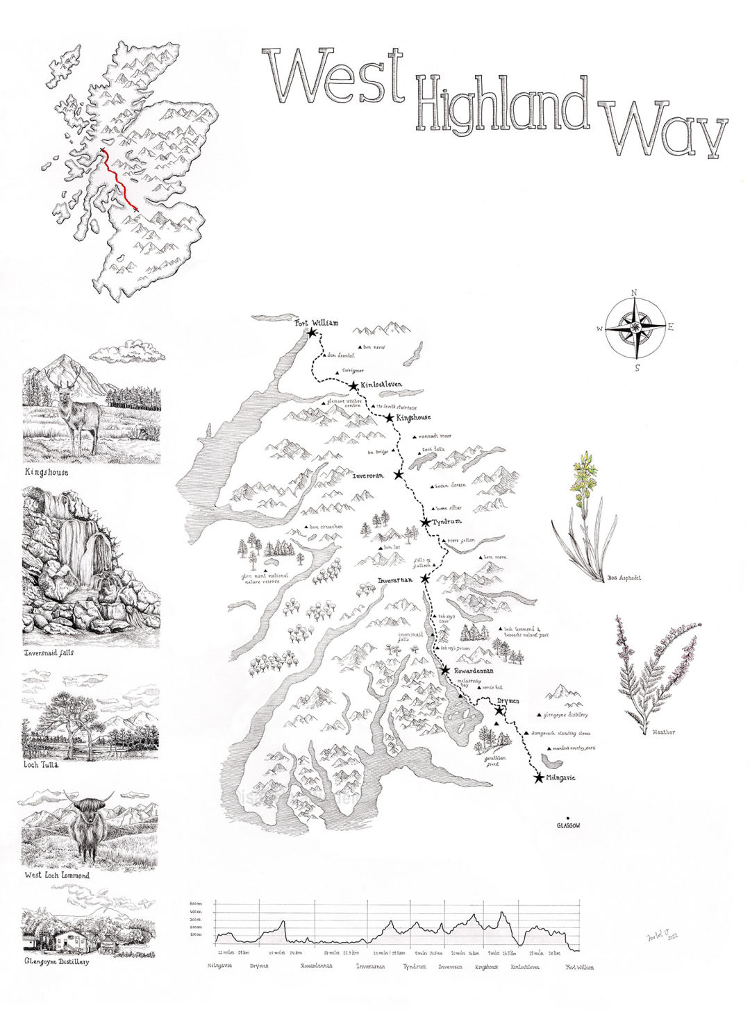
West Highland Way, Scotland
Handdrawn map. Trail map with marked places of West Highland Way:
- Milngavie - Drymen (12 miles)
- Drymen - Rowardennan (15 miles)
- Rowardennan - Inverarnan (14 miles)
- Inverarnan - Tyndrum (12 miles)
- Tyndrum - Inveroran (9 miles)
- Inveroran - Kingshouse (10 miles)
- Kingshouse - Kinlochleven (9 miles)
- Kinlochleven - Fort William (15 miles)
Some places are illustrated on the side.